Location, access and how to get there
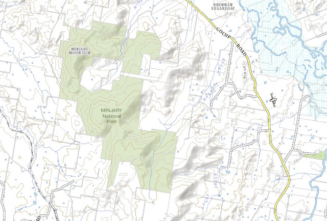
Minjary National Park is located 10 kilometers northwest of Tumut, around 185 kilometers (a 2 hour 10 minute drive) from Canberra GPO via Hume Highway and Gocup Road. The park is accessed via McGrath Trail (possibly also known as Burnie Trail) which runs off Gocup Road to the right about 25 kilometers south of Gundagai and enters the Park from the north. There is a gate where McGrath Trail enters the Park, and since there is no public vehicular access within Minjary, cars should be parked at the gate.
http://maps.six.nsw.gov.au/
Bushwalking opportunities
Walking is allowed in the Park and there are about 18 kilometers of management trails within the Park boundary, including one to the summit of Minjary Mountain, which the NSW National Parks and Wildlife Service tells me is worth a visit although views are limited by the vegetation. About one kilometer southwest of the Minjary Mountain trig, a little to the right of Minjary Trail, however, there is an old hang gliding ramp and there are excellent views from that area to the west. National Parks and Wildlife warn, however, that the ramp itself should not be stepped on due to its dilapidated state and the risk of falling through.
Camping and other facilities
Bush camping is permitted in the Park.
Features
Size
1,462 hectares.
Natural features
1,462 hectares.
Natural features
The highest peak is Minjary Mountain at 763 meters. Seven forest ecosystems have been identified within the Park which is part of the Murrumbidgee River catchment. Seven threatened species of fauna have been identified.
Heritage features
There are some Aboriginal heritage sites within the Park, and historical sites relating to the Park's former status as a State Forest.
References
Minjary National Park Plan of Management (2004) - link
National Parks and Wildlife Service - Minjary National Park website - link

No comments:
Post a Comment